Map a Pond with Satellite Imagery and LiDAR
Find a pond on satellite imagery, import available LiDAR terrain and review a detected water outline in Pond Tools.
Try this workflow
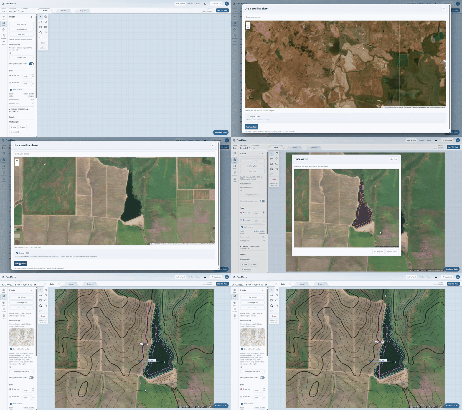
- Find the property in the satellite photo picker and choose the image area.
- Import available LiDAR terrain for the selected location.
- Review the detected water outline and adjust the pond contours as needed.
- Enter pond depths separately when estimating volume. Ground LiDAR does not measure underwater depths.